Part 2: The Climb and descent
Once in the park you can view the splendid valley but don’t keep your eyes off the road too long as there are plenty of corners and little between you and the edge of the mountain. Keep an eye out for cyclists as well and share the road, most of them are just trying to have fun like us. Weird way to have fun if you ask me.
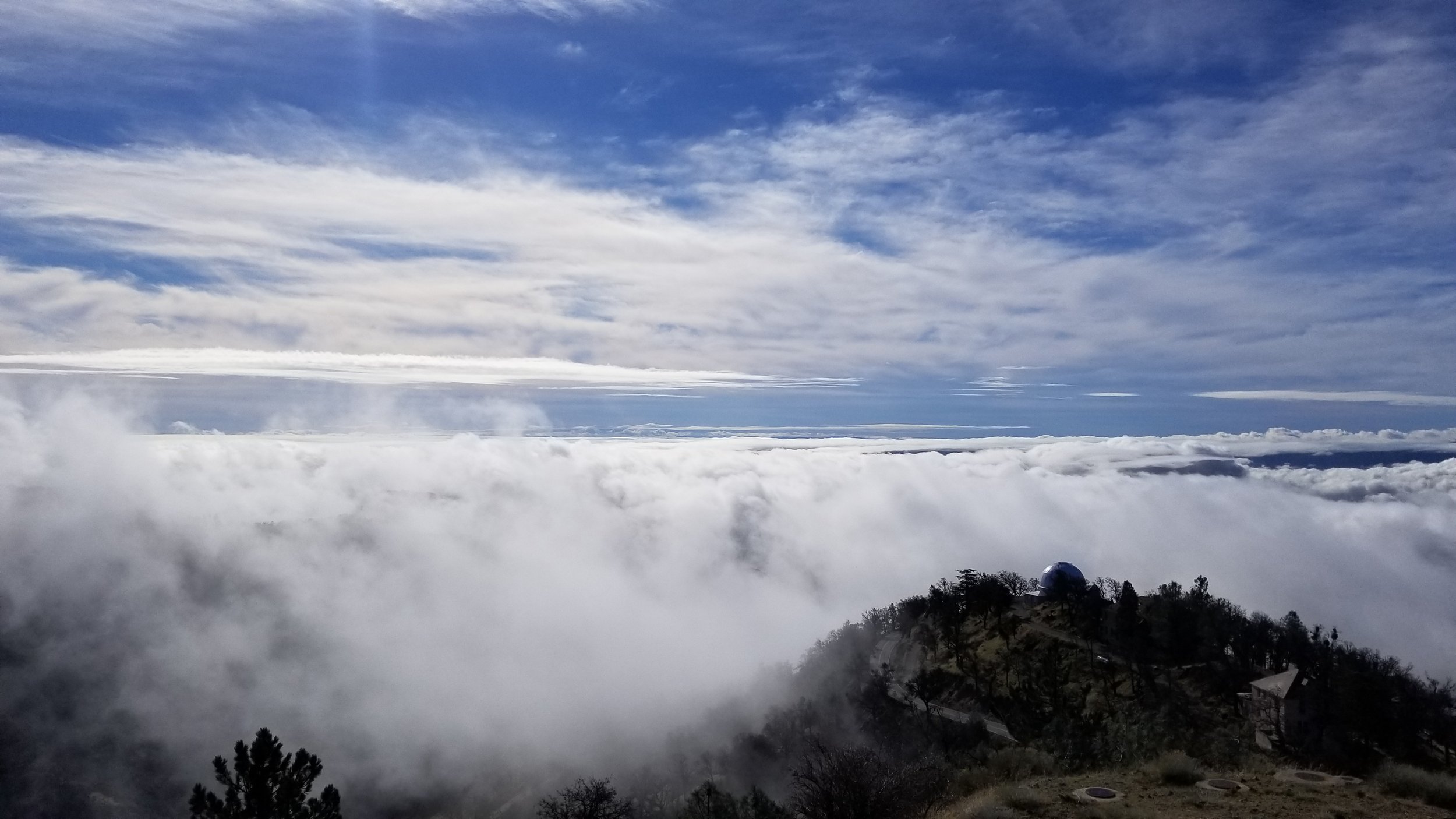
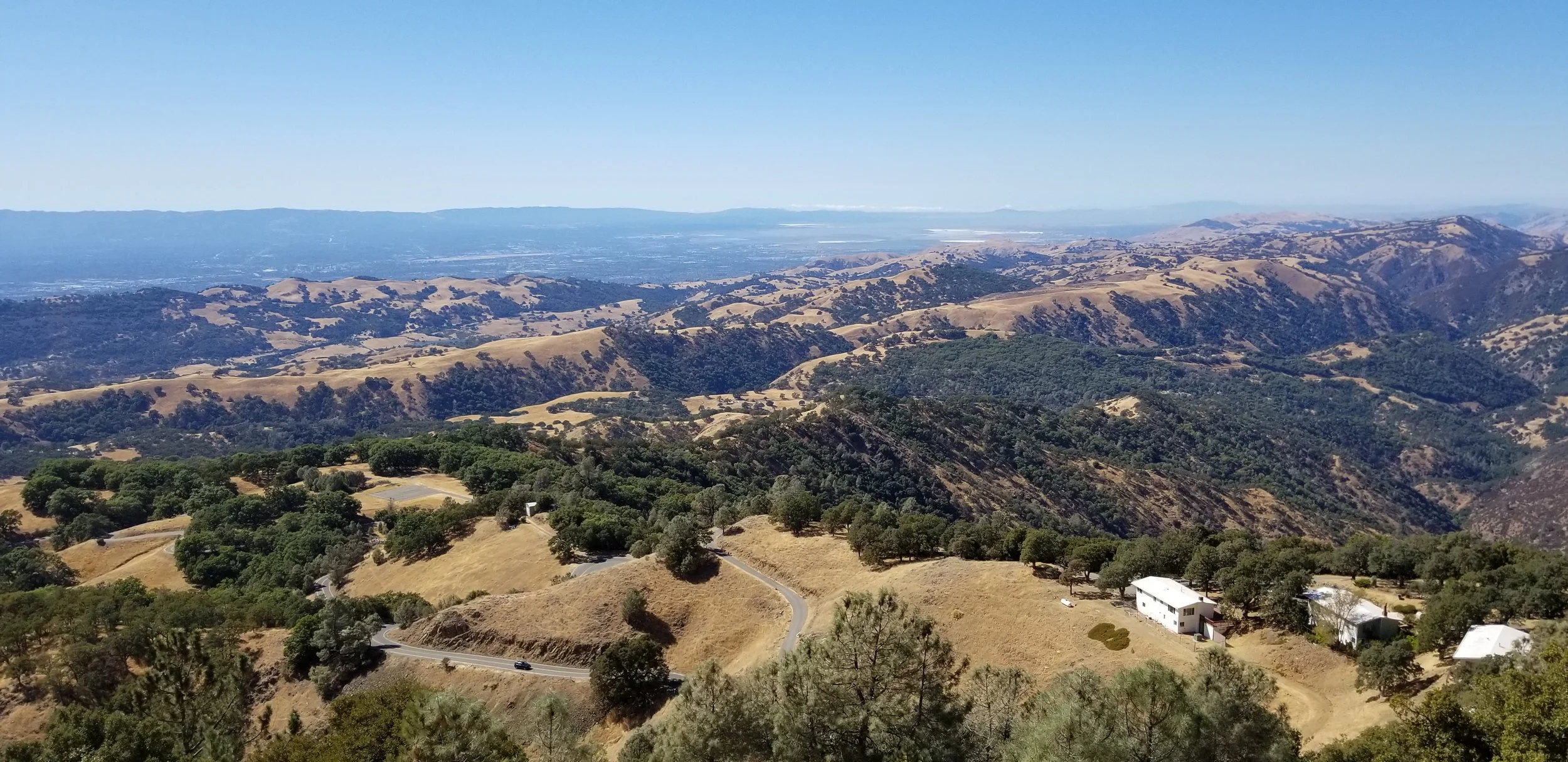
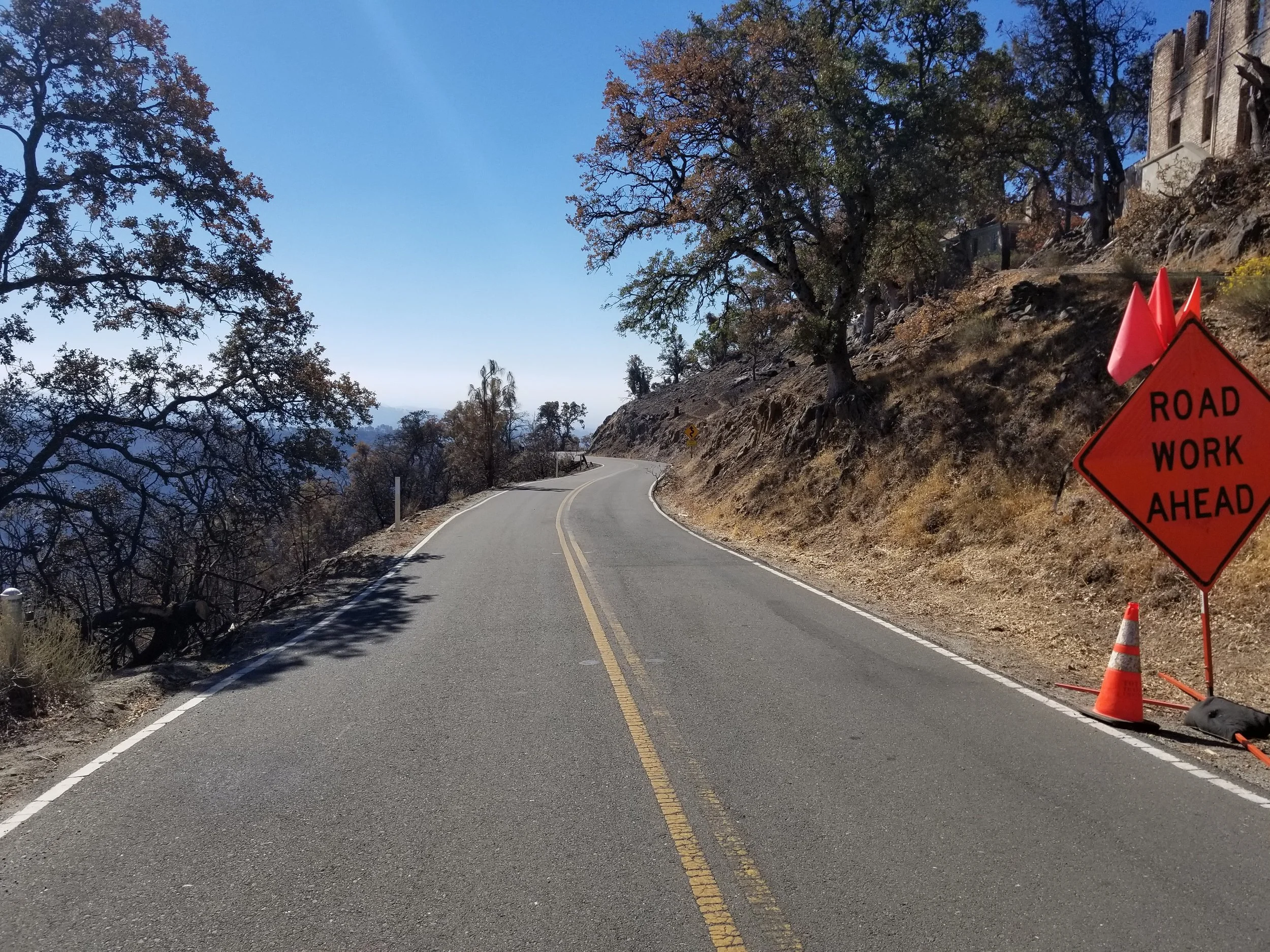
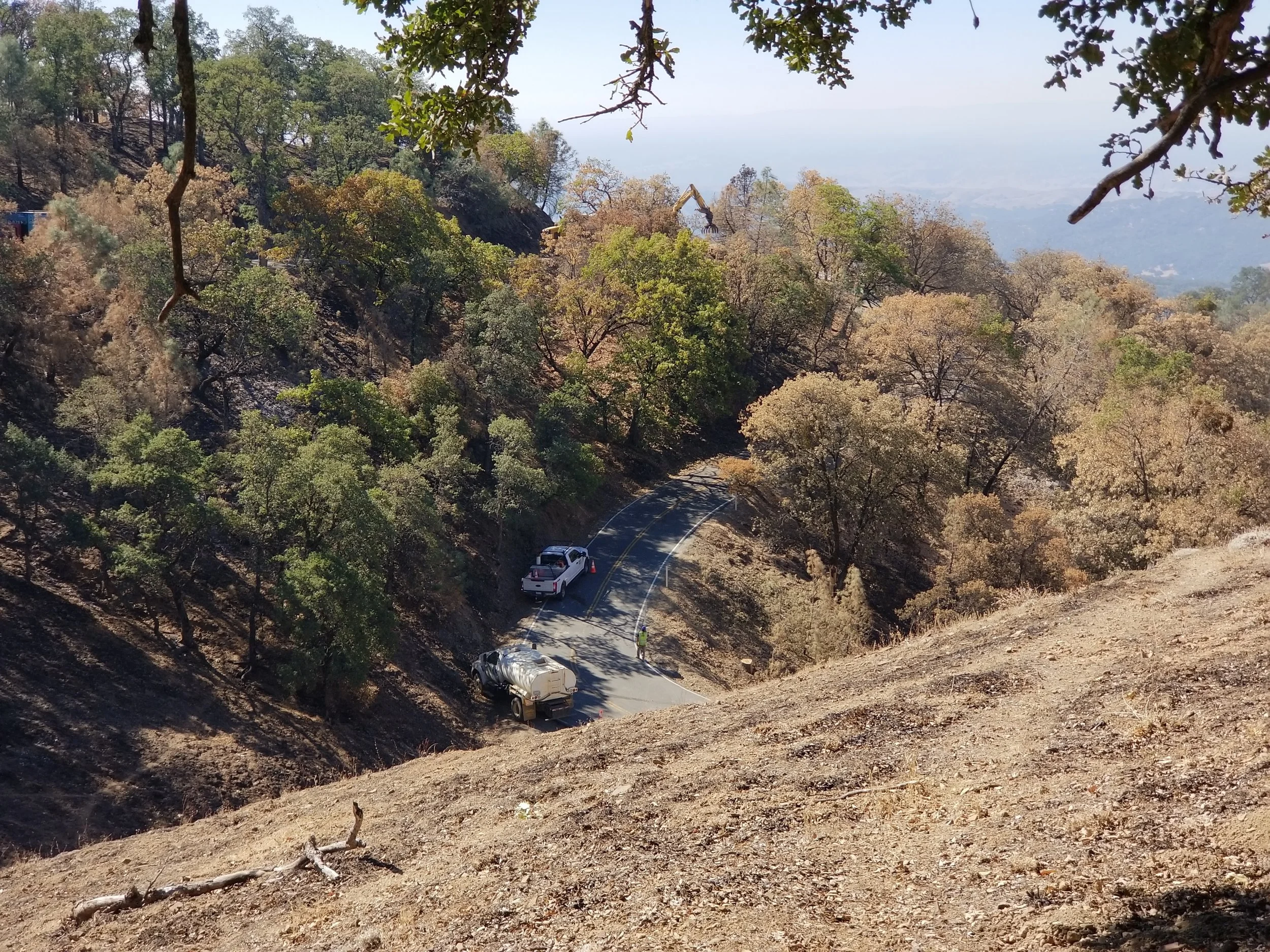
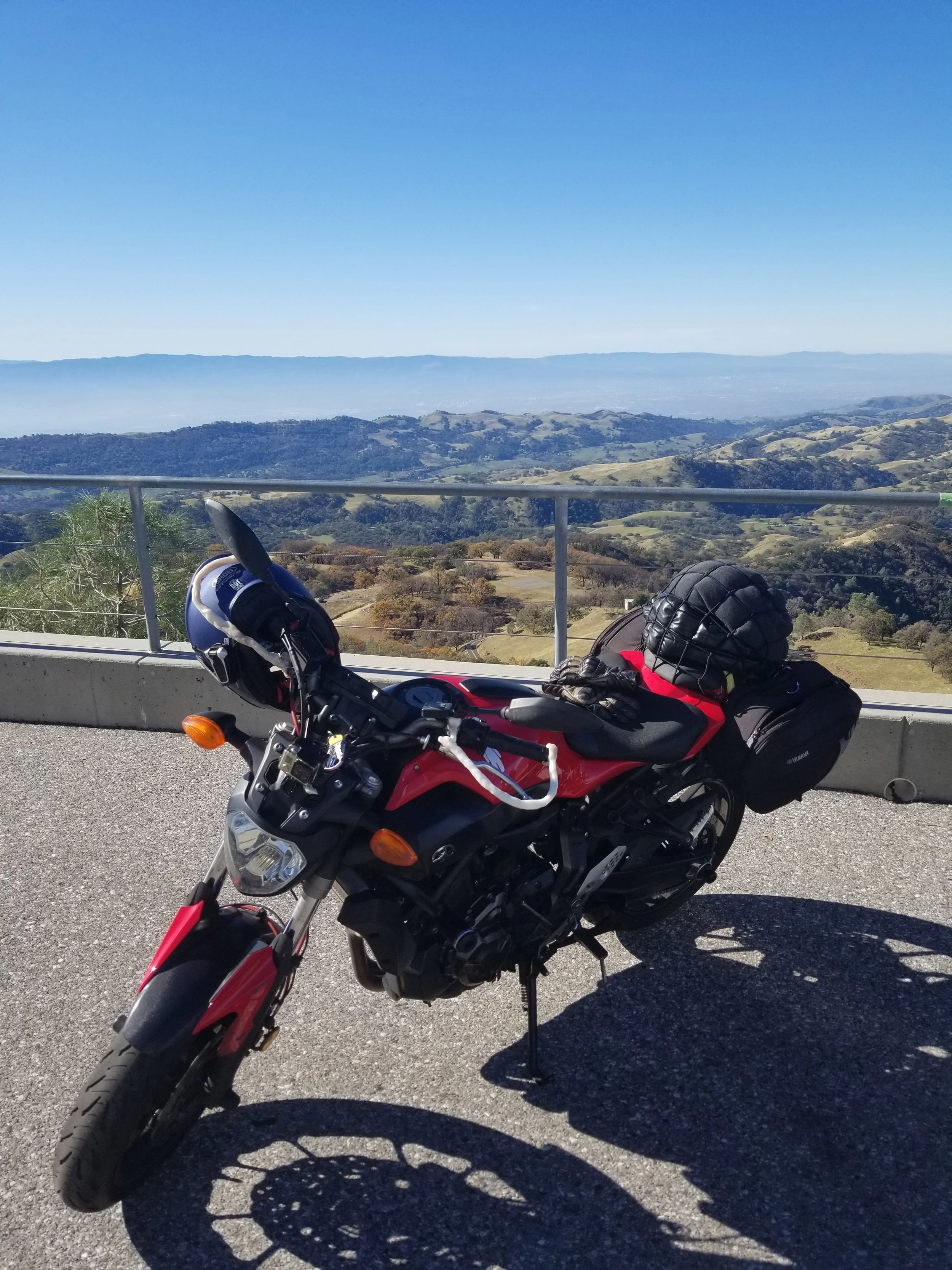
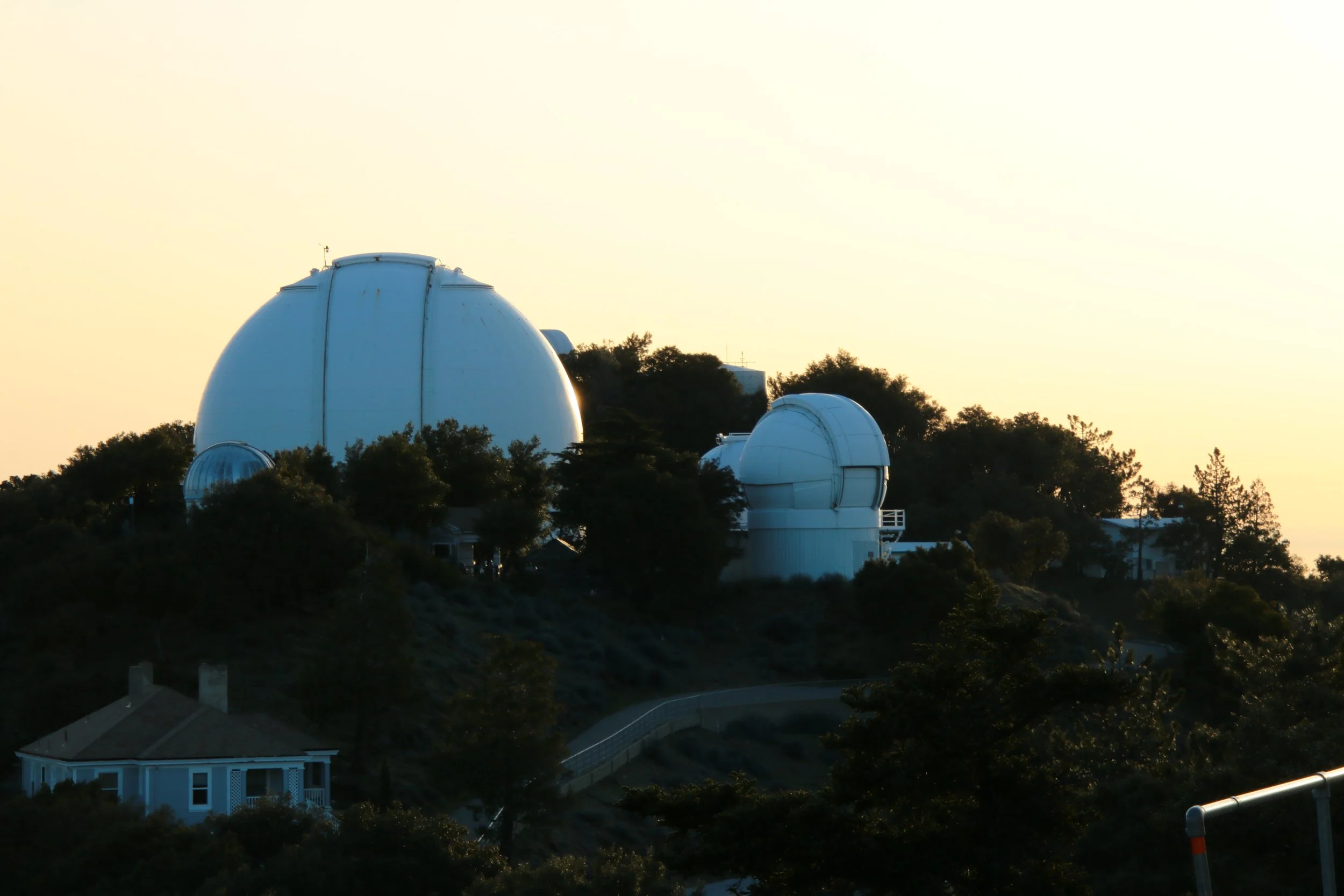
Watch out for gravel in turns for 2~3 weeks after any rains. Likewise there are almost always some rocks on the road where there are bare rock outcrops next to the road. If you manage to dodge all the obstacles and keep yourself on the road even with the view you will be rewarded at the top of Mt Hamilton with Lick Observatory. It is sometimes closed but if it isn’t I highly encourage you to stop, even if you do not go in. The view of the south bay is amazing, second to none.
The observatory is also amazing and parts of it are free to visit. I highly recommend the telescope visit as well, that thing is ridiculous! Speaking of, the Lick Observatory is active and has modern telescopes as well. There is one you can visit, but it is separate from the visitor center at the top. Only go there if you like museums and/or astronomy stuff.
The descent is very much exactly like the climb, but going downwards and into the San Antonio Valley. There are some U turns here that are just *chefs kiss*. There are fewer cyclists but there is a new obstacle in this part however, Cattle Guards. Don't be afraid of them and treat them like speed bumps. Get your butt up off the seat a few inches, keep the front wheel straight, dont brake or turn while over them, and you will be fine. Still watch out for gravel, especially in blind corners.
Part 3: San Antonio Valley
At some point you will go over a small curved bridge. To me this is the end of Mt Hamilton and the beginning of a gully that leads to the San Antonio Valley. You will notice some of the 2020 San Jose fire scars as you near the valley. Some of my favorite sets of corners are here, right before reaching the main valley and turning left. The cattle guards are all but done by this point, but do watch out for the little road squirrels. Seriously, they burrow into holes on the edges of the road surface.
The road in the valley is fairly straight and easy to go fast on. I will not say how fast I have gone, but do watch out as the road still does turn, and turns comes at you very fast when you are going, well… fast.
There is also a place called The Junction at the only junction on this road. It is a little diner place that 2 wheeled enthusiasts like to stop at. I go out for rides to ride so I tend to just keep going past. That road going east leads to the 5, and there isn’t much on the way or at the end. The main road north goes past a firehouse which symbolizes the return of curves.
From the Junction and going to nowhere map
Part 4: Canyons
This part is where some of the worst of the San Jose fires hit in 2020. As of 2022 there is some vegetation back but most of the trees are still gone or sickly looking. The curves tend to be nice and gentle, with one or 2 tighter U turns to watch out for.
At some point you will hit the County Line change. If you miss the sign you will notice the road going from having a center marker to it suddenly being gone. From here you now need to be careful about cars, motos, and bicycles, especially in corners. If you ride on the right side of the road and take corners carefully you should be fine. This area is also the most desolate and as far from help as you can get so even more reason to be careful. One upside of being so desolate is there are so few other people on the road here that you will make it through the canyons without encountering another vehicle.
At some point, the center road marker will come back, then disappear, then come back again. Civilization will also start coming back. The curves tend to be nice, but watch out for those with a tree or rocky outcrop at the apex. Both tend to have gravel in the apex year around. The Canyons end when the road ends and forces you to make a right turn.
Part 5: The end
After the right hander the road surface becomes very nice, but traffic tends to also increase so don’t go crazy. Nothing special but nothing bad to say about this bit. It ends when you reach another dead end at Tesla Road, next to a Beer Hops growery and brewery. You will likely go left, towards Livermore. I usually take Concanon road all the way to the 84 which starts my highway journey home.
My main takeaways:
This is likely my favorite route to ride, but it is also the longest, toughest, and least forgiving. Like I mentioned many times there is almost always some amount of gravel in some turns and there are parts with no center dividers. Make sure to fuel up before starting the ride since there is nothing between the start in the South Bay and Livermore. These combined with the lack of cell reception definitively means I recommend taking it easy and go with a friend if you can. Be mindful of the weather, know that it can vary greatly inland compared to in the bay. If you can, bring the basic first aid kits for people, tires, and motorcycles. But don't let all of this scare you, the ride is totally worth it and has plenty of spots where you can pull over and stop for a moment.
In my ~30 times doing this ride, I have popped a rear tire once, I slipped and fell on ice once, and ridden through or past snow about 5~8 times. I’ve seen and helped 2 different riders right after a crash, one of which required a helicopter airlift out of there. I’ve also seen one or 2 cars that have left the road and started going down the gullies including one or 2 abandoned cars. I have encountered cows on the road more than 5 times. I once or twice went after some rain and had to cross a few streams that were overflowing the road. I once saw 2 guys washing their pickup in one of these small streams crossing the road. I Never know what will happen when I go ride Mines Road, but I do know I will get home tired yet amazed and content with the ride.
The South East Bay Area has some of the best, and remote roads that I regularly ride. There aren’t many roads I ride out there but those few are also some of my favorites.
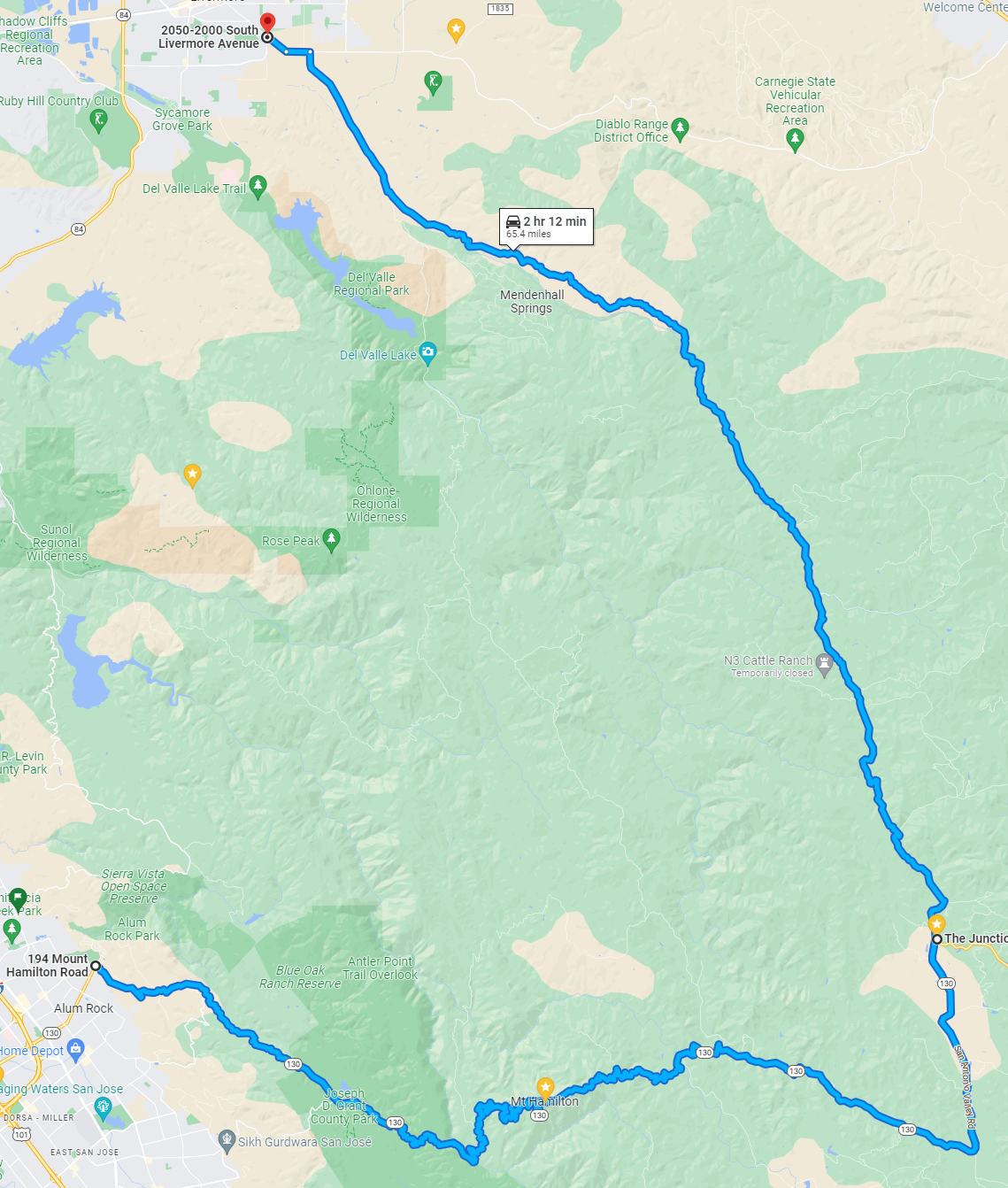
1- Mines road
In short: This somewhat difficult 2ish hour long ride starts in the south, goes up to Mt Hamilton, goes down on the back side, flies past a place called The Junction, and winds its way up to Livermore. It can be done in reverse, starting in Livermore (as I often do).
It is best to come prepared for this trip. It gets super hot in the summer so bring water, and there can be snow and ice in the winter. The road surface can also be rough on your tires. Cell phone reception is minimal at best, and it is often devoid of other people in all forms.
Part 1: The Start
CA road 130 is named Mt Hamilton road, likely because it is the road that goes to the top of Mt Hamilton. Starts in residential Alum Road, has a few decent turns, then weaves its way through the eastern foothills. Be careful here after rains as mud likes to make its way onto the road.
There is also an optional start in East San Jose with Quimby Road. It is a bit smaller and slower, but has a few ridiculous curves which are somewhere between fun and terrifying. Both of these lead to the Grant County Park.

view from the top of Mt Hamilton
view from the top of Mt Hamilton

view from the top of Mt Hamilton
view from the top of Mt Hamilton

view from the top of Mt Hamilton
view from the top of Mt Hamilton

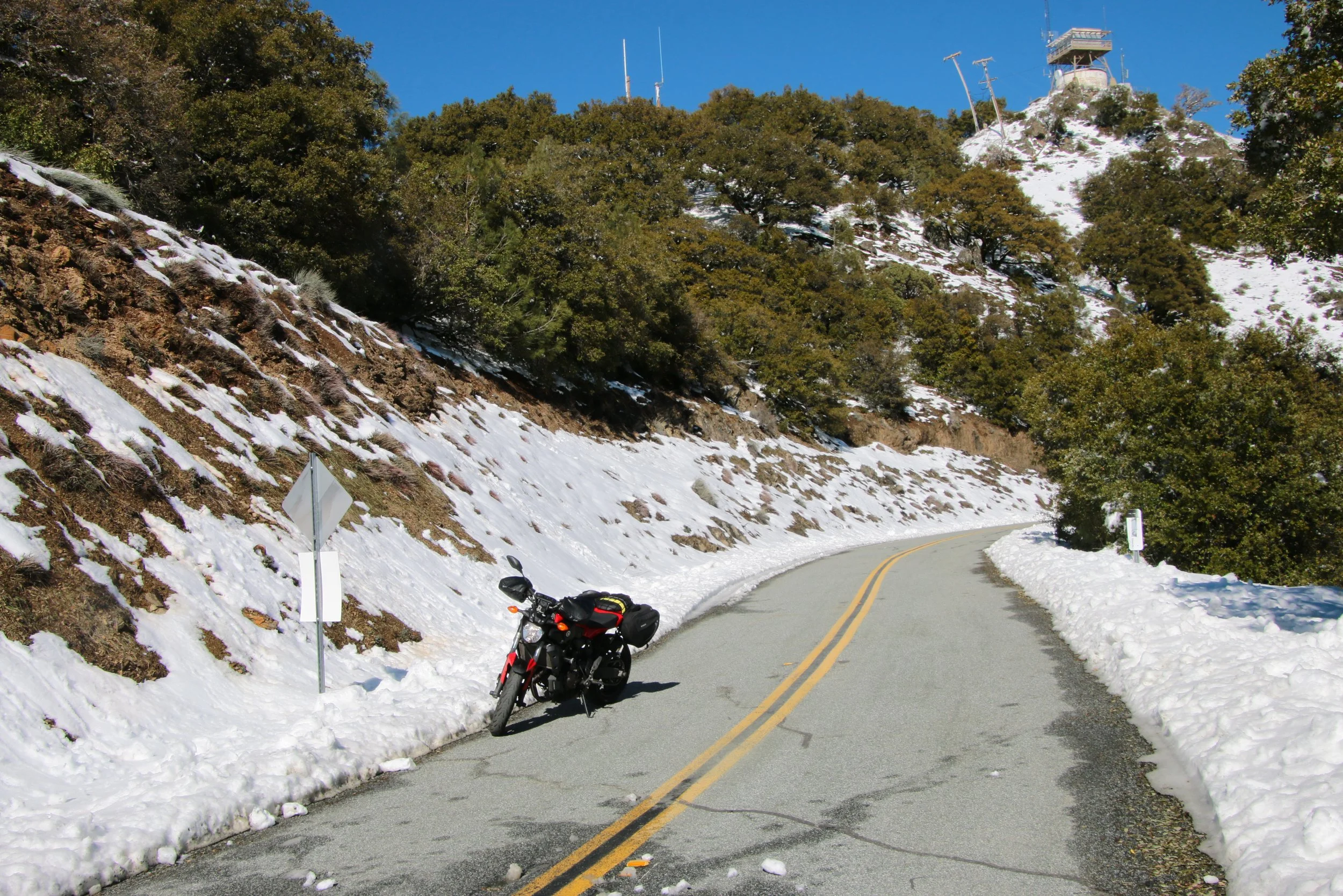
Snow and ice on the descent of the backside of Mt Hamilton

snow deep in Mines road

sunrise from the top of Mt Hamilton

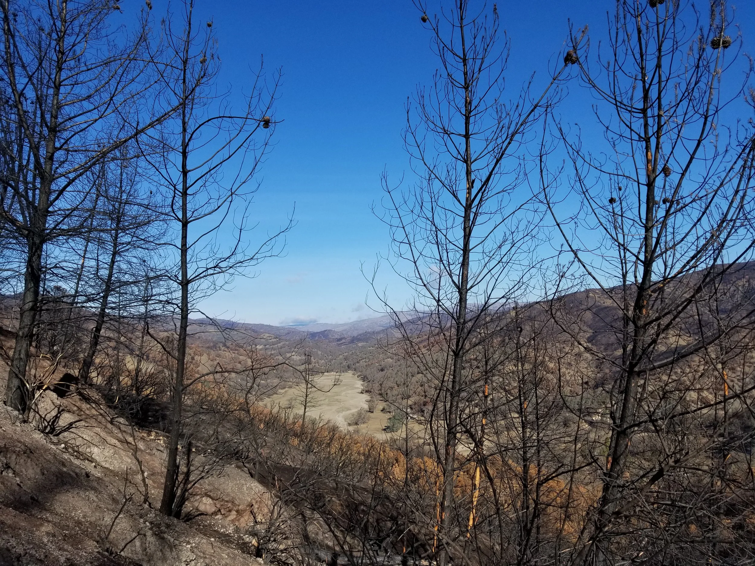
view from the top of Mt Hamilton after the 2020 San Jose fire

view from the top of Mt Hamilton after the 2020 San Jose fire

view from the top of Mt Hamilton after the 2020 San Jose fire

view from the top of Mt Hamilton after the 2020 San Jose fire
view from the top of Mt Hamilton after the 2020 San Jose fire

view from the top of Mt Hamilton after the 2020 San Jose fire

view from the top of Mt Hamilton after the 2020 San Jose fire

view from the top of Mt Hamilton after the 2020 San Jose fire
view from the top of Mt Hamilton after the 2020 San Jose fire

view from the top of Mt Hamilton after the 2020 San Jose fire

The plug on the rear puncture I got when I was about as far away from civilization as I could get

The location where I stopped after I noticed my rear had punctured

a cloudy start towards the Livermore part of Miners road

a cloudy start towards the Livermore part of Miners road

After the 2020 San Jose fire

After the 2020 San Jose fire
After the 2020 San Jose fire
view from the top of Mt Hamilton

view from the top of Mt Hamilton

view from the top of Mt Hamilton

Clouding climb of Mt Hamilton

Clouding climb of Mt Hamilton
Clouding climb of Mt Hamilton
Clouding climb of Mt Hamilton

view from the top of Mt Hamilton
view from the top of Mt Hamilton

view from the top of Mt Hamilton

After the 2020 San Jose fire and a cattle guard on the left

After the 2020 San Jose fire
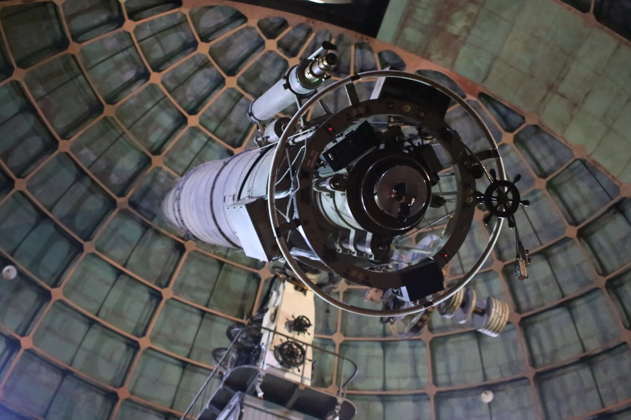
The old telescope inside the observatory
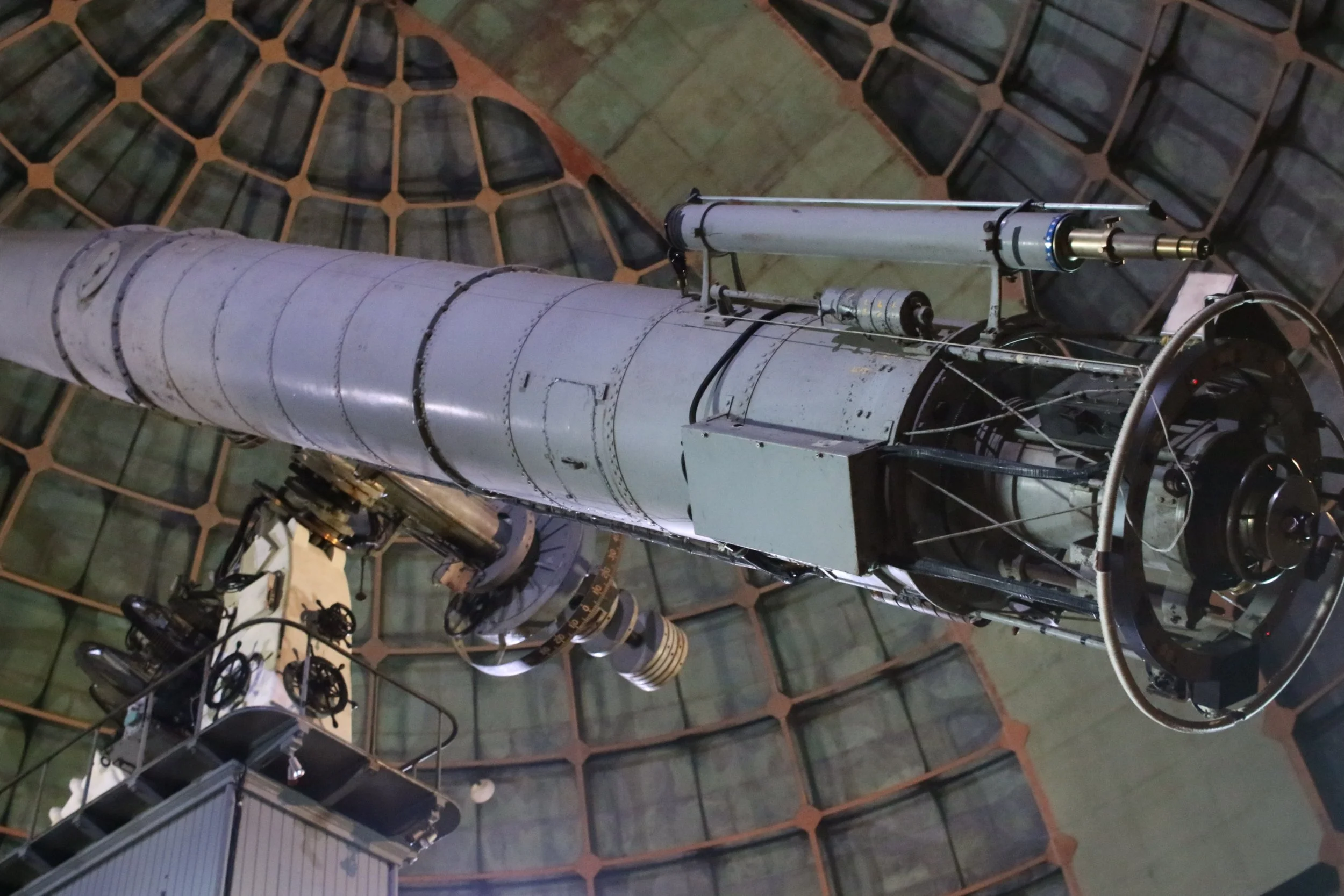
The old telescope inside the observatory
snow at the top of Mt Hamilton
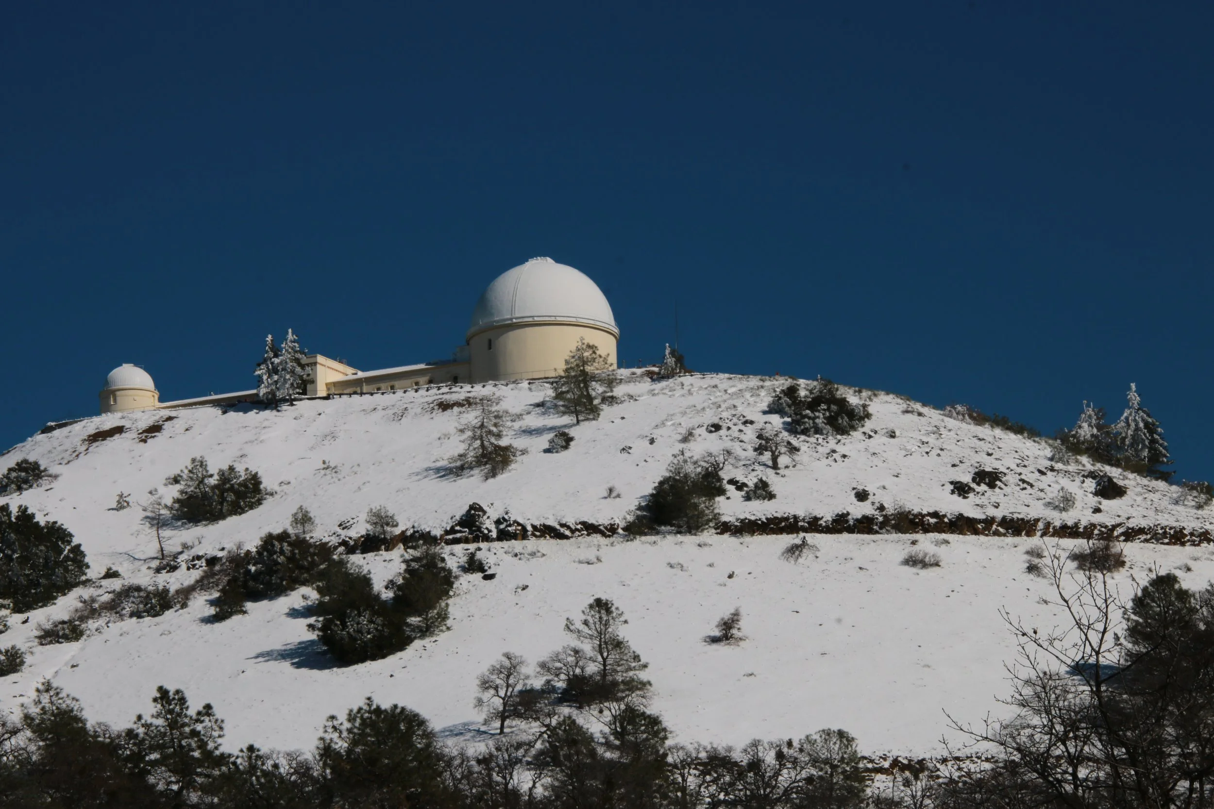
snow at the top of Mt Hamilton
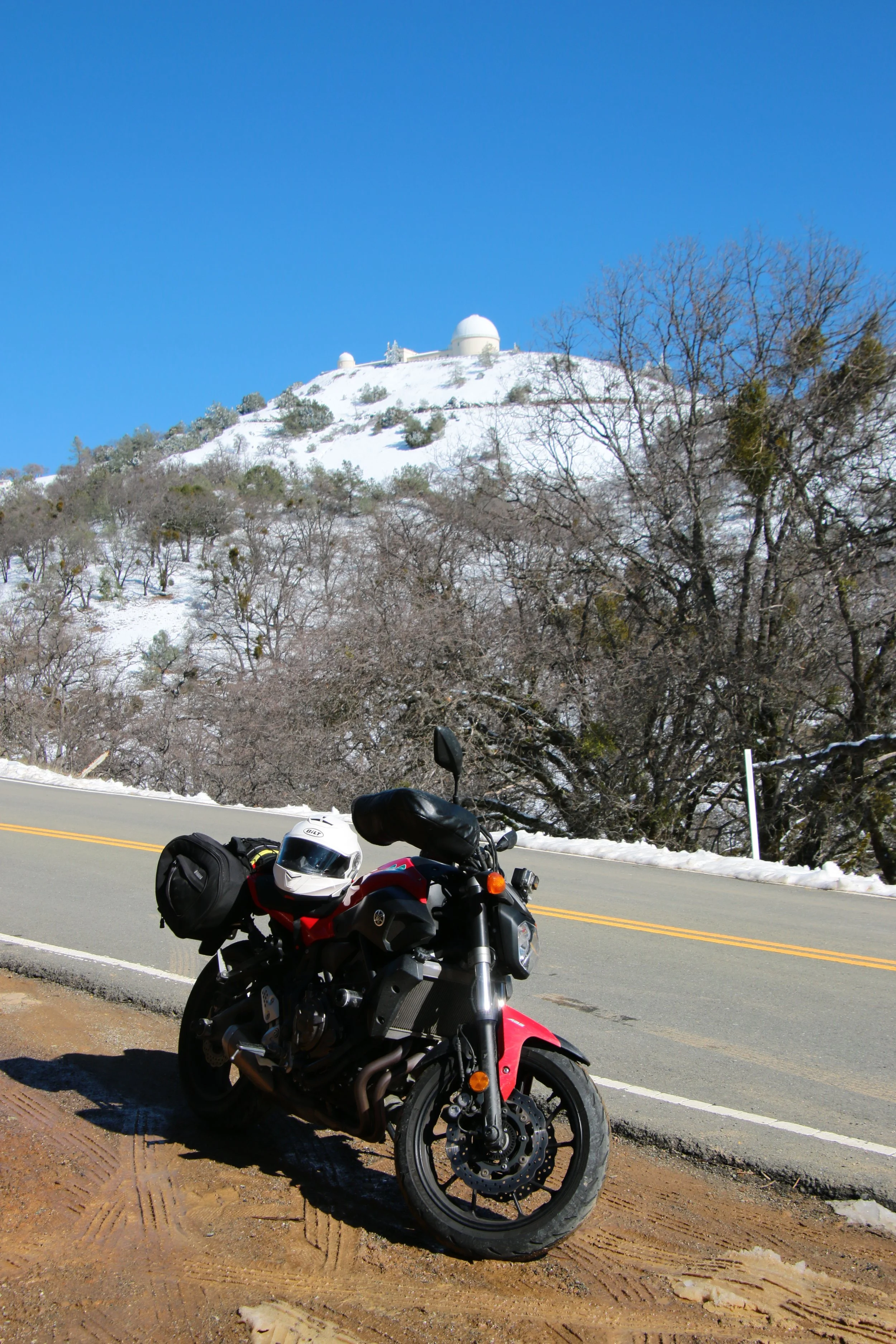
snow at the top of Mt Hamilton
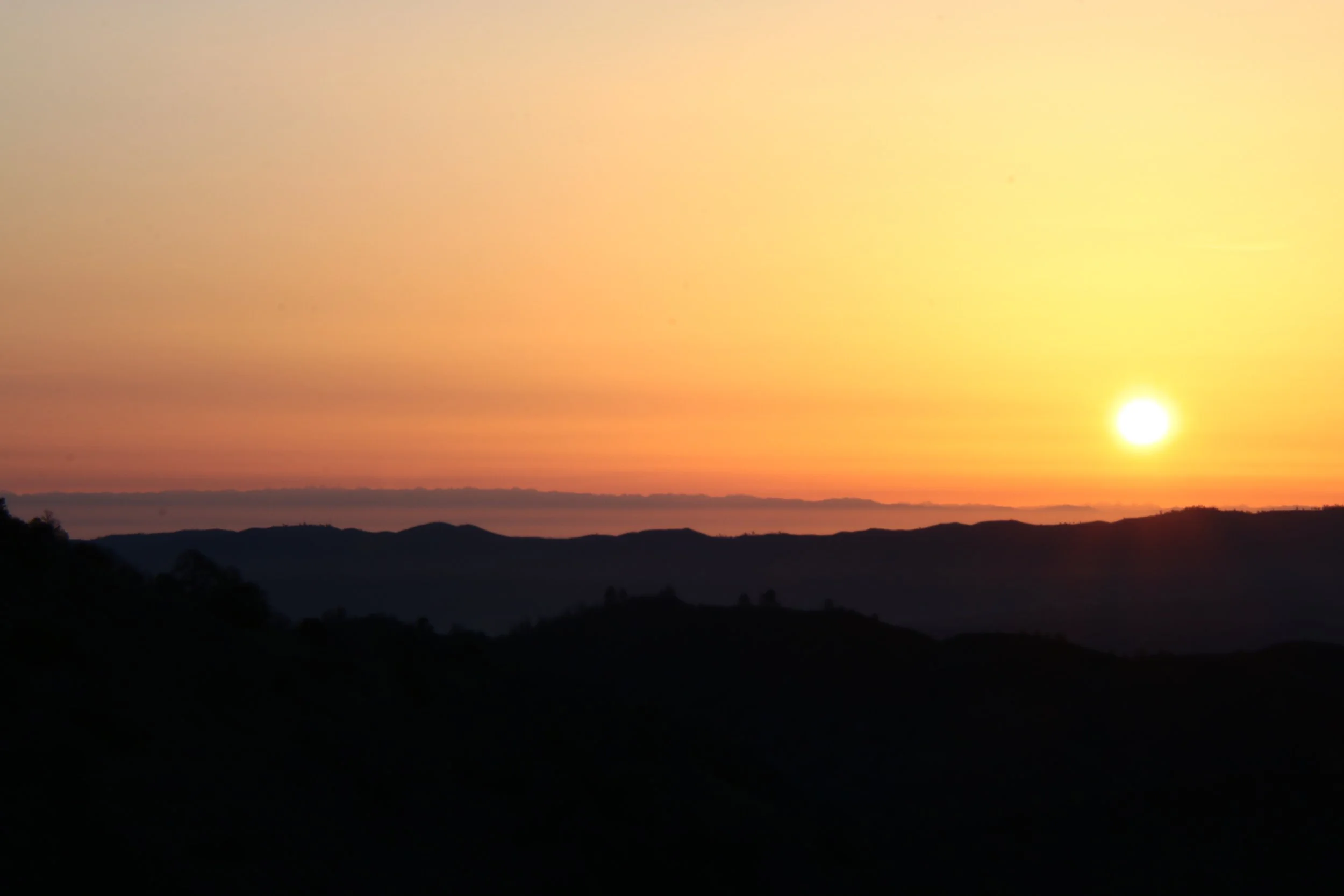
sunrise from the top of Mt Hamilton
sunrise from the top of Mt Hamilton
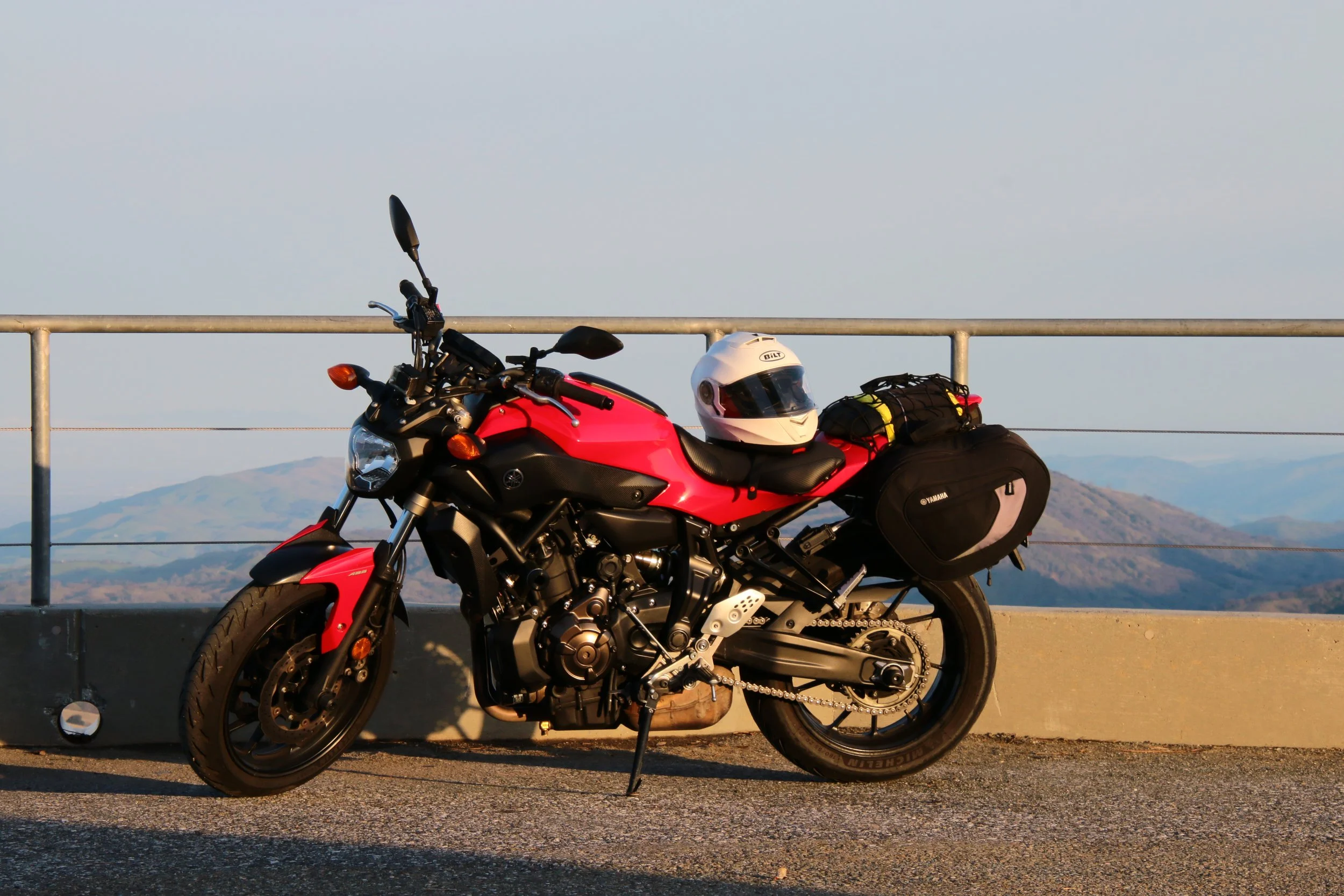
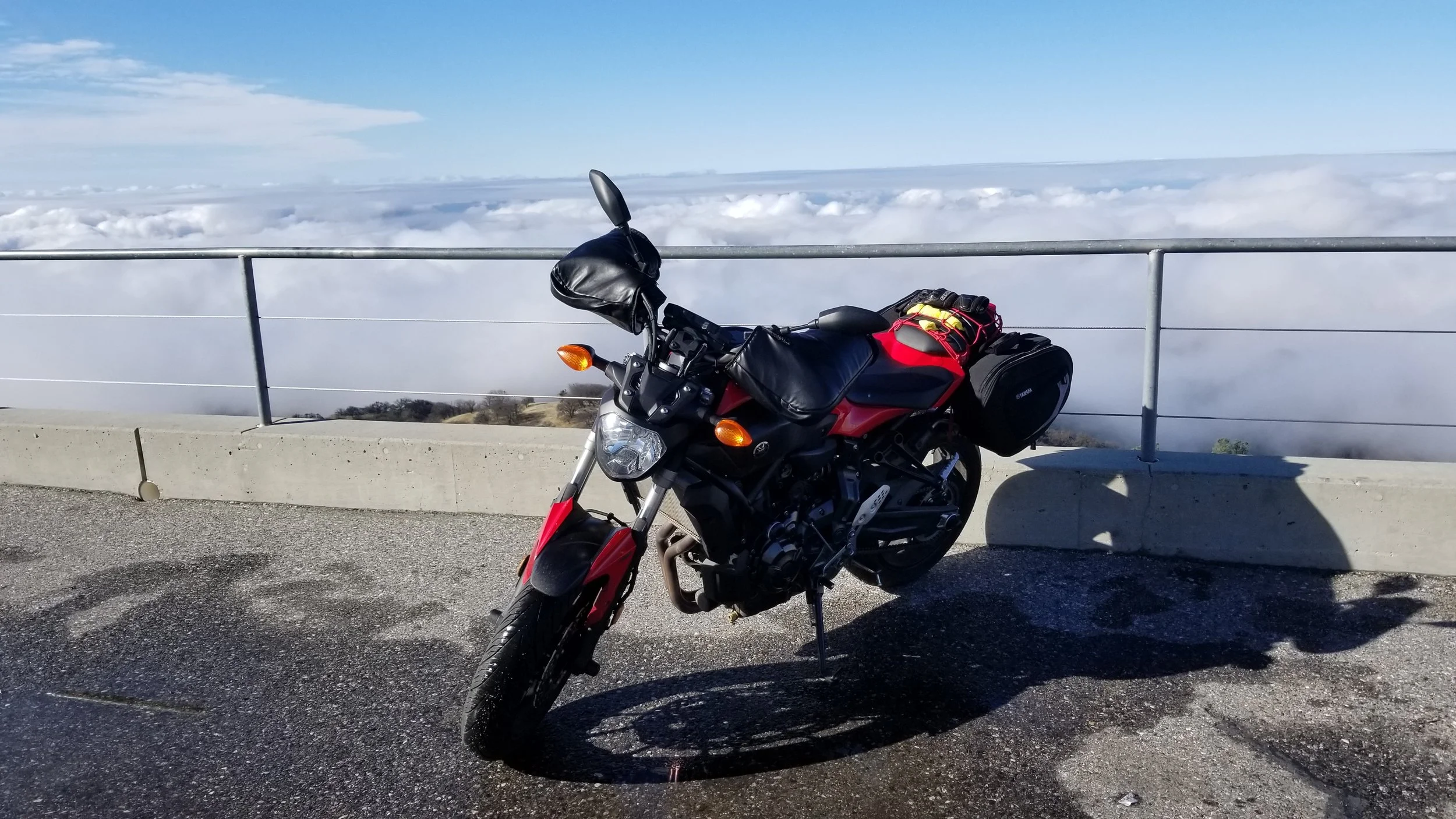
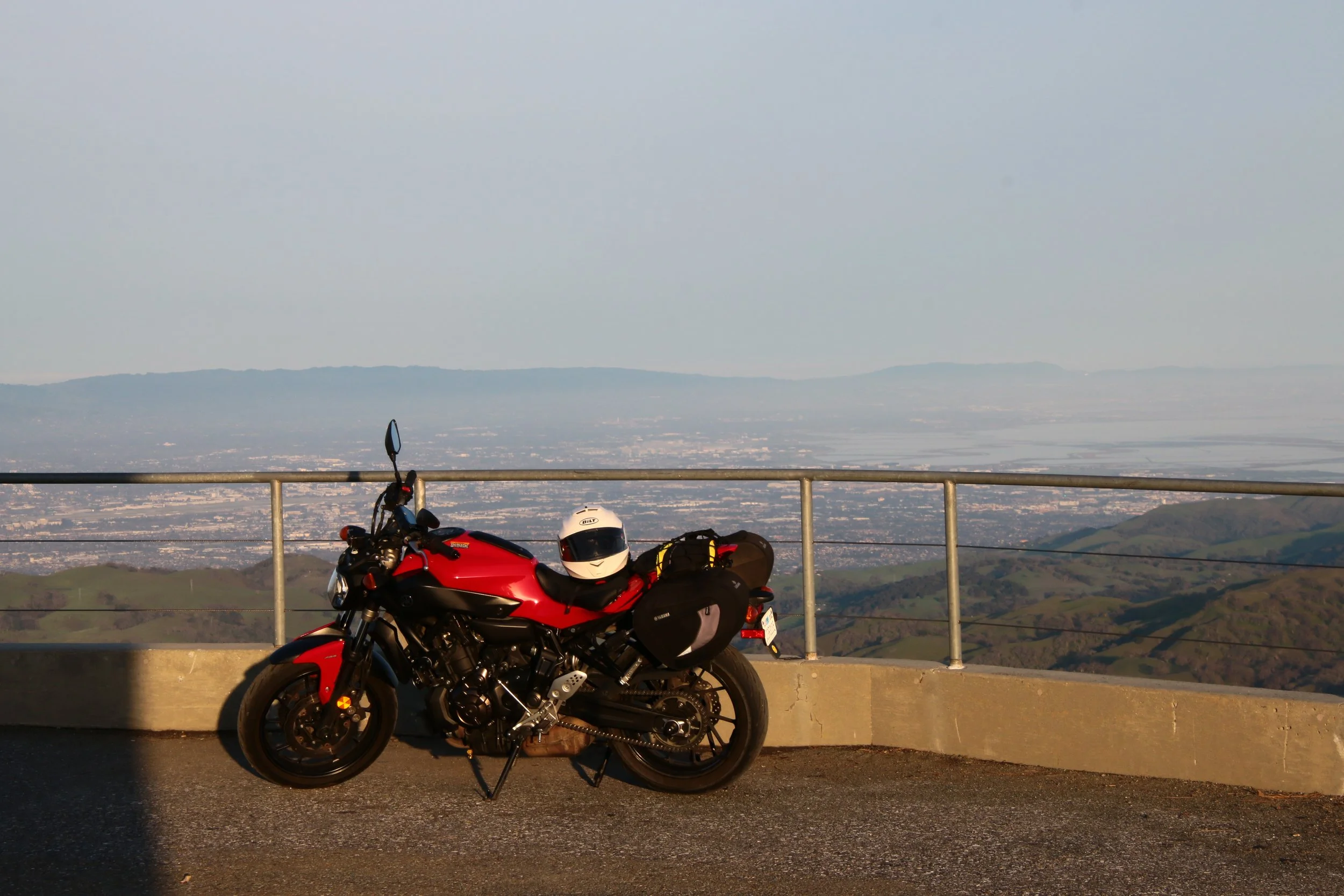
my bike at sunrise at the top of Mt Hamilton
sunrise from the top of Mt Hamilton
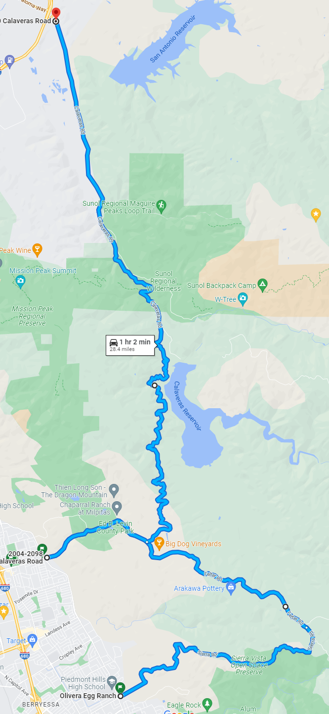
2- Calaveras (Little Yosemite)
In short: This is a nice route through a splendid valley some call Little Yosemite. Some care needs to be taken as the tiny road has no center lane markers but direction goes both ways. There are also always bicyclists here, so be careful going around the many tight blind curves. It can also easily be looped in with a Mines Road trip since they both start and end in similar locations.
Part 1: North part, Alameda County
This north part of Calaveras road is in Alameda county. They’ve maintained the road surface to a good quality and repaired most of the parts that were damaged by the San Jose fires of 2020. You may understand later why I am bringing this up now.
Starting from the north end this part of Calaveras road is nothing special. There are a few commercial production plants so watch out for the rare truck but the more common gravel in the intersections to their entrances. Otherwise the road is smooth, has a few small curves, and is way too easy to go too fast on so watch yourself. This section ends in a right hand turn that will sneak up on you badly if you go too fast.
You will see a Park entrance road on the left but there is nothing but the park that way. Keep going straight and head into the tunnel of trees. Keep an eye out for branches, leaves, and rocks that fall on the road. If it has rained in the past week or 2 there may also still be dampness in the more shady parts of the road. Watch out for cars, cyclists, and other motorcyclists in blind corners. There is something about these no center lane and not too often traveled roads that make some people feel like they can clip the corners and use the entire lane, even if they cant see what’s around the corner. At some point the tree tunnel will just become trees and open up to reveal the Calaveras Reservoir and valley.
Part 2: South part, Santa Clara County
You will know when you hit Santa Clara county because there will be a little sign that says so but mostly because the road quality degrades badly, quickly. It is still fine to ride on but the surface instils less confidence to me and there also tend to be more little gravel bits. The quality varies greatly based on general location and how long it has been since it last rained.
That doesn’t stop this part from still having splendid views and some great curves. Same as the north part, watch out for cars and cyclists, but rejoice a little as there are plenty of parts here that do have a center lane painted and mostly observed. The road ends in a steep downhill with a stop at the bottom so take it easy and come in slow. If you are done take a right to stay on Calaveras and wind your way down to civilization.
Part 3: The extension
If you want to go a little longer you can make a left at the stop. This will take you through some fairly big houses out in the hills before it wraps around and bring you back towards San Jose. The directions are easy, stay on the main road until you hit civilization again. That’s it, just don’t get tempted by some of the smaller side street (unless you like that sort of thing).
Road quality doesn’t improve too much from Part 2 but it also doesn’t really get much worse. Do watch out as you near the peak as there is a very popular park up there. I once got stuck in a bit of traffic as people were trying to turn into the parking lot from a direction they were not supposed to. It was so bad there was a park ranger there to deal with the parking issues. There are also a few tight downhill turns once you get back into the housing areas so don’t go too fast.
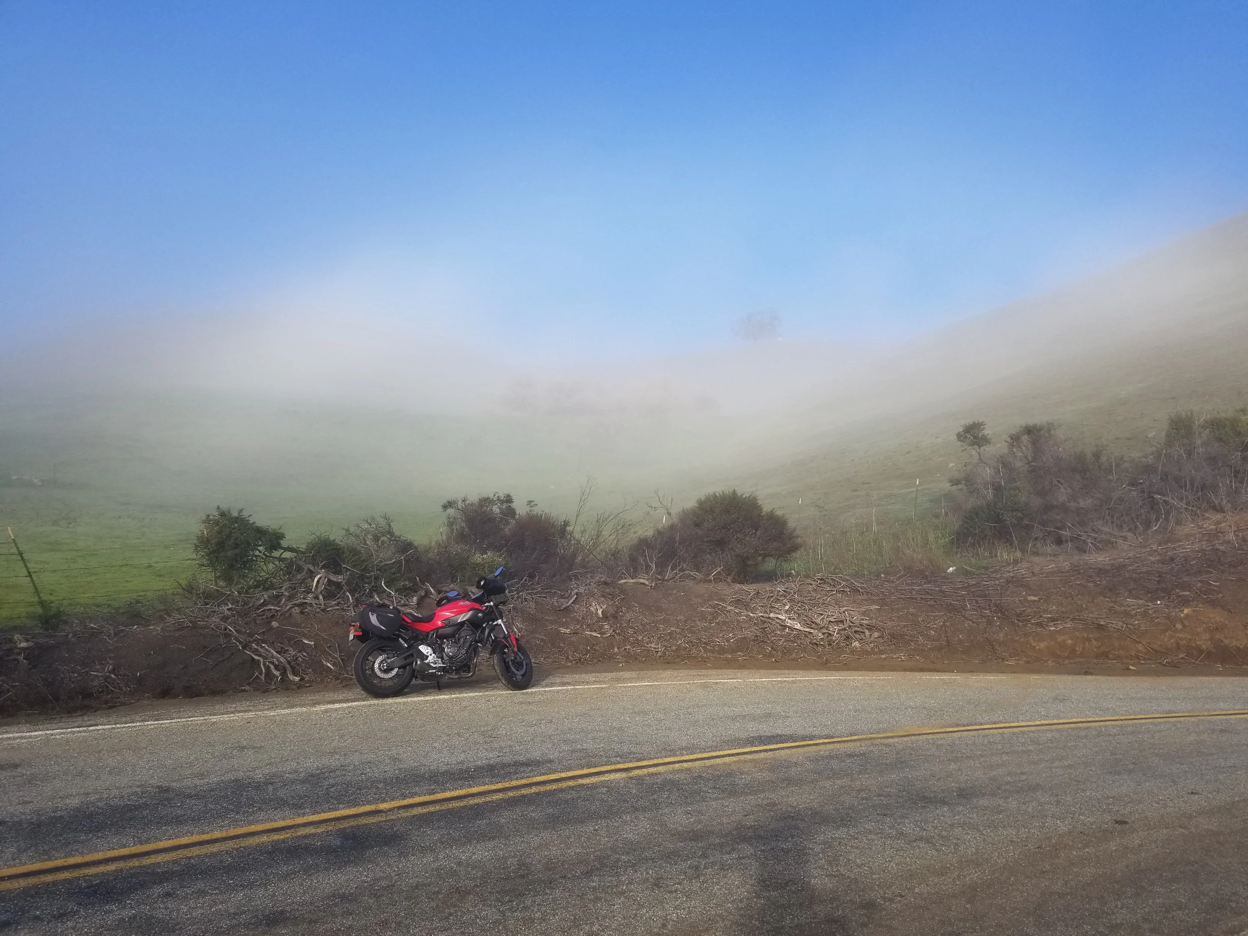
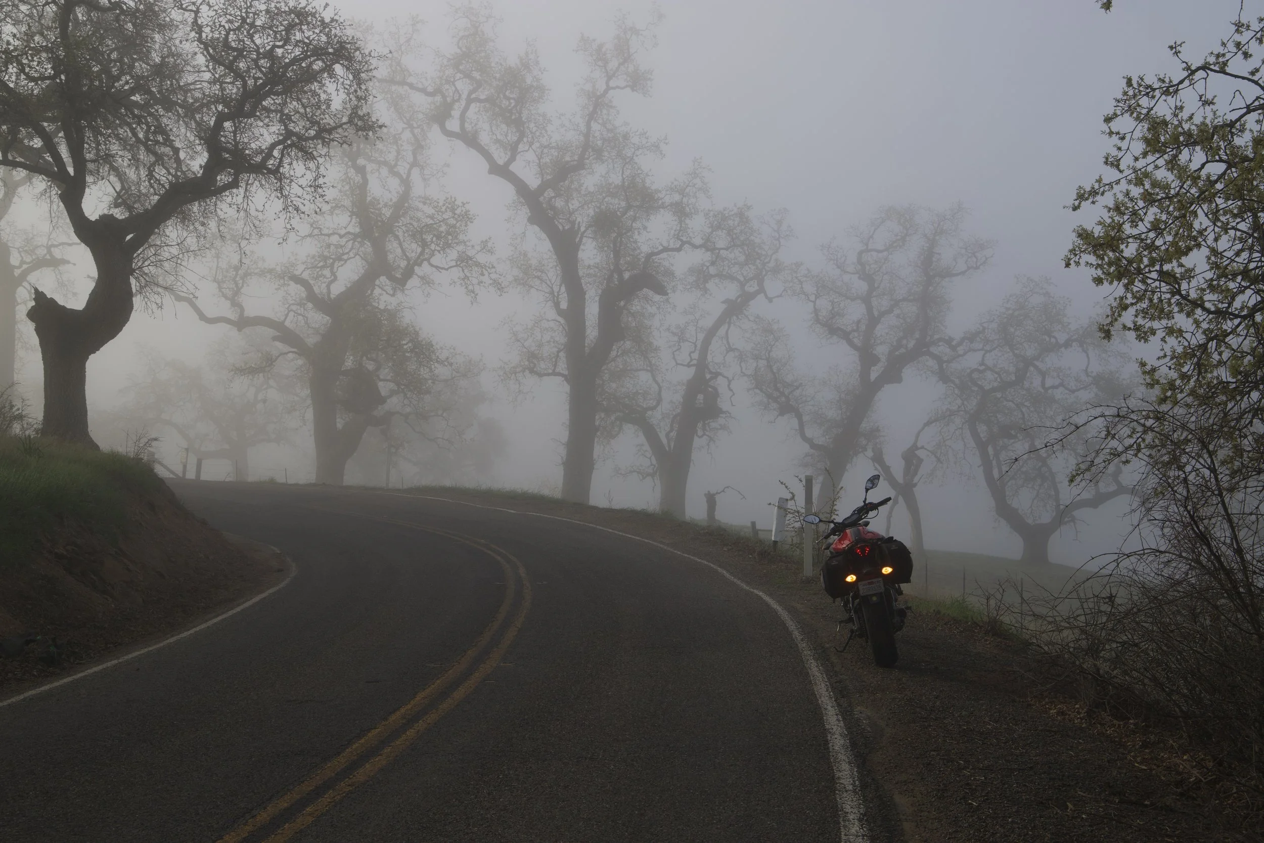
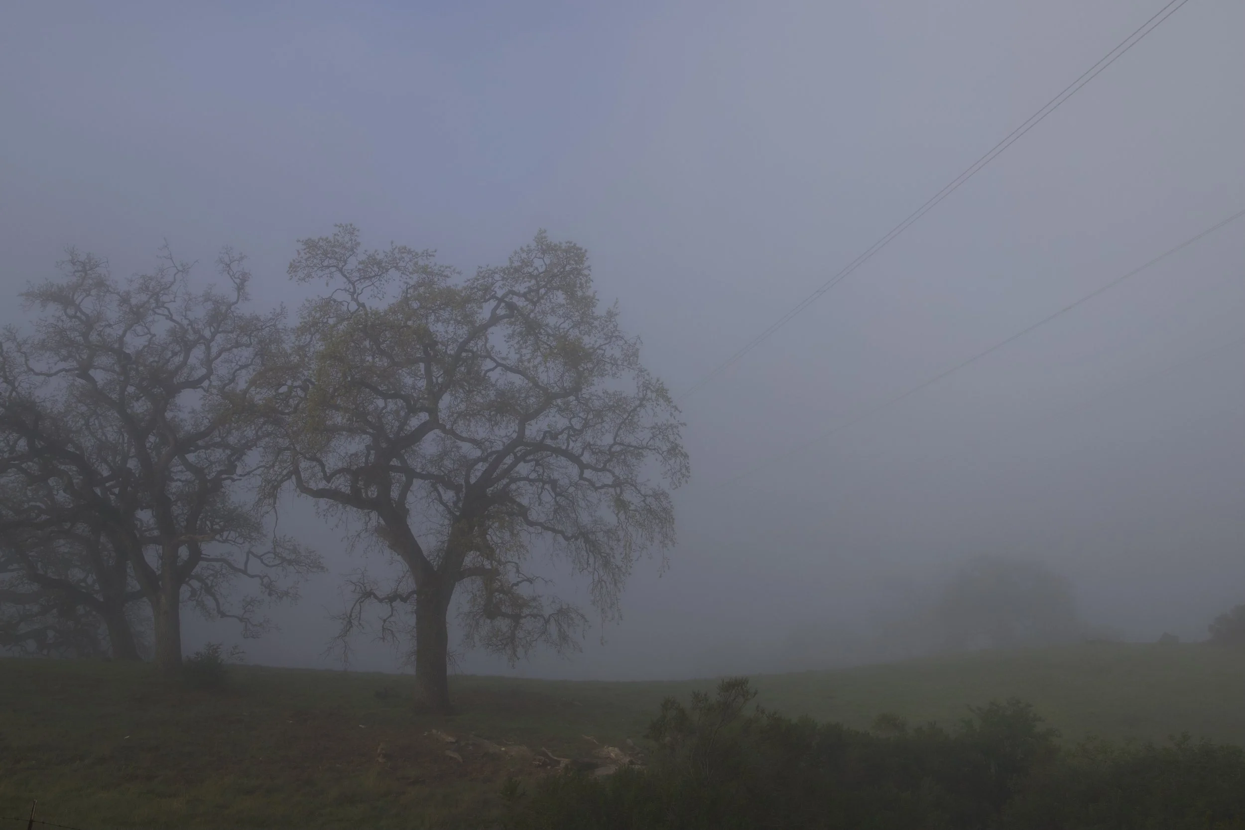
foggy morning

foggy morning

foggy morning

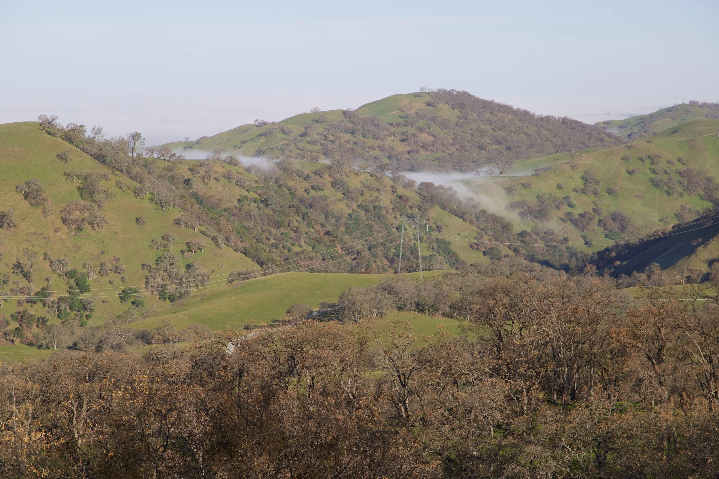
View of the reservoir
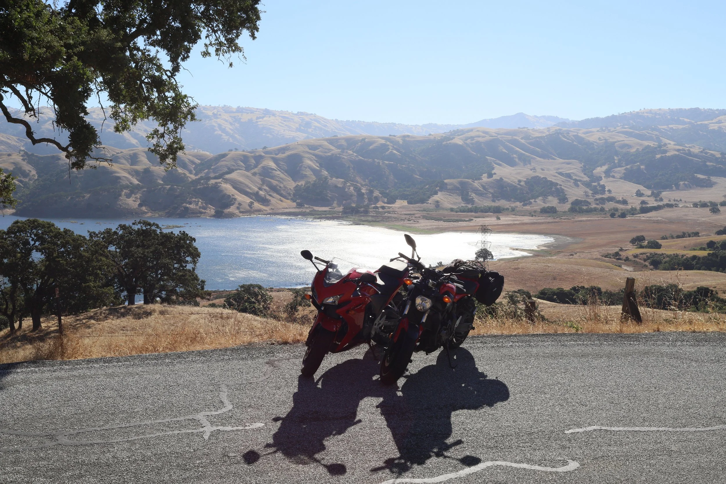
View of the reservoir